EXPLORE THE TOWNS OF MOORA
Koojan
Koojan is a small town located between Moora and Bindoon in the Wheatbelt region of Western Australia.
When the Midland railway was opened in 1894 the site of the present town was established as a railway siding. Some time afterward the area was surveyed and subdivided and the town was gazetted in 1910.
The town is named after the Aboriginal word for a nearby pool of the Moore River. The name was first recorded on maps which were surveyed in 1861 but the meaning of the word is unknown.
Koojan Walk Trails
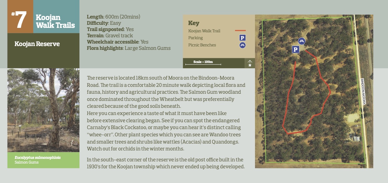
Koojan Reserve
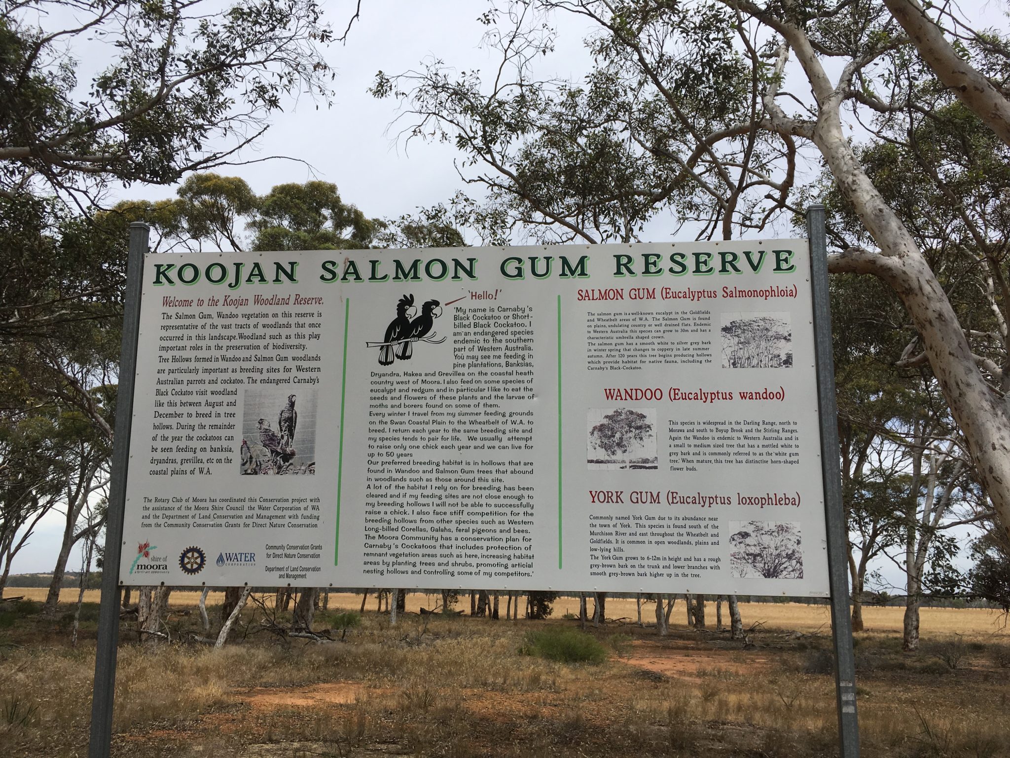
The reserve is located 18km south of Moora on the Bindoon-Moora Road. The trail is a comfortable 20 minute walk depicting local flora and fauna, history and agricultural practices. The Salmon Gum woodland once dominated throughout the Wheatbelt but was preferentially cleared because of the good soils beneath. Here you can experience a taste of what it must have been like before extensive clearing began. See if you can spot the endangered Carnaby’s Black Cockatoo, or maybe you can hear it’s distinct calling “whee-orr”. Other plant species which you can see are Wandoo trees and smaller trees and shrubs like wattles (Acacias) and Quandongs. Watch out for orchids in the winter months. In the south-east corner of the reserve is the old post office built in the 1930’s for the Koojan township which never ended up being developed.
Length: 600m (20mins)
Difficulty: Easy
Trail signposted: Yes
Terrain: Gravel track
Wheelchair accessible: Yes
Flora highlights: Large Salmon Gums
Koojan Walk Trails
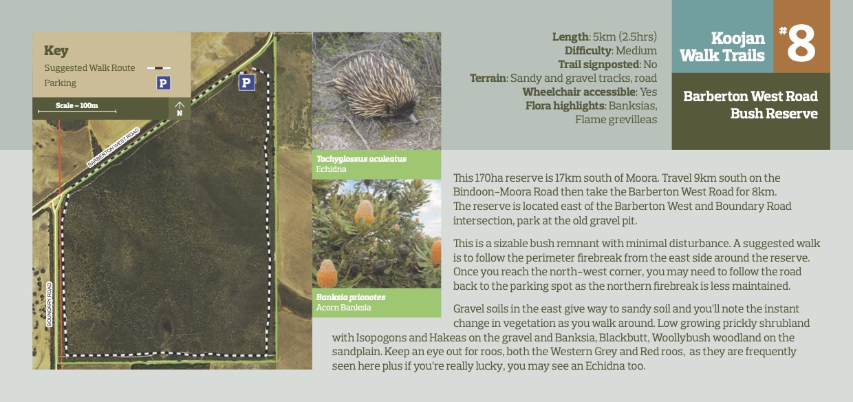
Barberton West Road Bush Reserve
This 170ha reserve is 17km south of Moora. Travel 9km south on the Bindoon-Moora Road then take the Barberton West Road for 8km. The reserve is located east of the Barberton West and Boundary Road intersection, park at the old gravel pit. This is a sizable bush remnant with minimal disturbance. A suggested walk is to follow the perimeter firebreak from the east side around the reserve. Once you reach the north-west corner, you may need to follow the road back to the parking spot as the northern firebreak is less maintained. Gravel soils in the east give way to sandy soil and you’ll note the instant change in vegetation as you walk around. Low growing prickly shrubland with Isopogons and Hakeas on the gravel and Banksia, Blackbutt, Woollybush woodland on the sandplain. Keep an eye out for roos, both the Western Grey and Red roos, as they are frequently seen here plus if you’re really lucky, you may see an Echidna too
Length: 5km (2.5hrs)
Difficulty: Medium
Trail signposted: No
Terrain: Sandy and gravel tracks, road
Wheelchair accessible: Yes
Flora highlights: Banksias, Flame grevilleas


